Schärligbad Circular Hike in Marbach (Lucerne)

📍 Marbach, Lucerne | 🥾 Route: Schärligbad – Pfyffer – Rämisgummen | 🏔️ Heart-shaped route & crocus magic

Discover the fascinating heart-shaped route in the UNESCO Biosphere Entlebuch. This diverse circular hike takes you from Marbach over the scenic Pfyffer to Rämisgummen, which shines in a spectacular sea of crocuses in April. A tour for true connoisseurs who want to combine natural wonders with a culinary finale at Restaurant Schärligbad.

Click here for Videos, Facts & Figures, Map, Review, Dine Tip.

.ugb-026c5e2 .ugb-icon__icon .ugb-icon-inner-svg{color:#6ec1e4 !important}.ugb-026c5e2 .ugb-icon__icon{margin-bottom:1px !important}.ugb-026c5e2 .ugb-icon__title{font-family:-apple-system,BlinkMacSystemFont,”Segoe UI”,Roboto,Helvetica,Arial,sans-serif,”Apple Color Emoji”,”Segoe UI Emoji”,”Segoe UI Symbol” !important;margin-bottom:1px !important}@media screen and (min-width:768px){.ugb-026c5e2.ugb-icon{padding-right:35px !important;padding-left:35px !important}.ugb-026c5e2 > .ugb-inner-block > .ugb-block-content > *{min-height:0px}}@media screen and (max-width:1025px){.ugb-026c5e2 .ugb-icon__content-wrapper{column-gap:0px !important}.ugb-026c5e2 .ugb-block-content{column-gap:0px !important}}@media screen and (min-width:768px) and (max-width:1025px){.ugb-026c5e2 .ugb-icon__title{margin-bottom:-43px !important}}@media screen and (max-width:768px){.ugb-026c5e2 .ugb-icon__icon .ugb-icon-inner-svg,.ugb-026c5e2 .ugb-icon__icon .ugb-icon-inner-svg svg{width:35px !important;height:35px !important}.ugb-026c5e2 .ugb-icon__title{margin-bottom:-50px !important}.ugb-026c5e2 .ugb-icon__content-wrapper{column-gap:0px !important}.ugb-026c5e2 .ugb-block-content{column-gap:0px !important}.ugb-026c5e2 > .ugb-inner-block > .ugb-block-content > *{justify-content:stretch}}.ugb-026c5e2 .ugb-icon__icon .ugb-icon-inner-svg,.ugb-026c5e2 .ugb-icon__icon .ugb-icon-inner-svg svg *{color:#6ec1e4 !important;fill:#6ec1e4 !important}@media screen and (max-width:768px){.ugb-026c5e2 > .ugb-inner-block > .ugb-block-content > *{padding-top:0px !important;padding-right:0px !important;padding-bottom:0px !important;padding-left:0px !important}}

3.5 h

11 km

+555 hm
-551 hm

Medium

Map

GPX

4/5

Getting there

.ugb-c9bf864-wrapper.ugb-container__wrapper{border-radius:10px !important;border-style:solid !important;border-color:#6ec1e4 !important;border-top-width:2px !important;border-right-width:2px !important;border-bottom-width:2px !important;border-left-width:2px !important}.ugb-c9bf864 .ugb-inner-block{text-align:center}@media screen and (min-width:768px){.ugb-c9bf864 > .ugb-inner-block > .ugb-block-content > *{padding-top:30px !important;padding-bottom:30px !important;padding-right:30px !important;padding-left:30px !important}}

Videos of the Schärligbad Circular Hike

Schärligbad circular hike Marbach Entlebuch crocus bloom
▶️ Video on Instagram
Circular hike Schärligbad – Rämisgummen – Pfyffer in Entlebuch – Hiking tip from Hike&Dine
▶️ Video on Instagram

Free Map & GPX Download: Schärligbad Circular Hike

On Schweiz Mobil, you can view a free map of the hike and download the GPX file. You can find the route on Komoot here. Please note: I completed the hike in the opposite direction to the one shown on Komoot. I have also included a link to a PDF description of the hike from Restaurant Schärligbad. From there, you can see the heart shape of the hike even better.

Facts and Figures: Schärligbad Hike

SectionDescription
Starting pointRestaurant Schärligbad, Marbach (parking lot)
Getting thereCar; train to Escholzmatt, rent a “Sponti-Car” if necessary
Highest pointRämisgummenhoger
DifficultyT2 (Mountain hiking)
Durationapprox. 3:30 hours
Distance11 km
Altitude meters555 m up, 551 m down
RouteSchärligbad – Balmegg – Pfyffer – Rämisgummen – Geissholle – Sattel – Schärligbad
Best timeApril (crocus bloom) to October
HighlightsHeart-shape of the route, sea of crocuses at Rämisgummen, panorama (Schrattenfluh, Beichlen range, Hohgant, Niesen, Stockhorn, Blüemlisalp)
EquipmentSturdy shoes, water, sun protection, camera, snacks
Refreshments / FoodMountain Restaurant Erika (towards the end of the tour) & Restaurant Schärligbad (start/finish)
.ugb-64cc271-wrapper.ugb-container__wrapper{border-radius:10px !important;border-style:solid !important;border-color:#6ec1e4 !important;border-top-width:2px !important;border-right-width:2px !important;border-bottom-width:2px !important;border-left-width:2px !important}.ugb-64cc271 .ugb-inner-block{text-align:center}@media screen and (min-width:768px){.ugb-64cc271 > .ugb-inner-block > .ugb-block-content > *{padding-top:30px !important;padding-bottom:30px !important;padding-right:30px !important;padding-left:30px !important}}

Matthias Dine-Tip

Restaurant Schärligbad in Marbach Entlebuch – Culinary Tip by Hike&Dine

Restaurant Schärligbad in Marbach Entlebuch – Culinary Tip by Hike&Dine
▶️ Video on Instagram

fter the hike, genuine Entlebuch hospitality awaits you at Restaurant Schärligbad. This historic establishment focuses consistently on regional products—a highlight being the juicy veal Cordon Bleu. To top it off, treat yourself to the “Z’Beschtä vom Wüudä Weschte” dessert while reflecting on your heart-shaped tour.

.ugb-5ab98c0 .ugb-block-content .ugb-button{border-radius:10px}.ugb-5ab98c0 .ugb-button1{background-color:#fcb900;border-radius:10px !important}.ugb-5ab98c0 .ugb-button1 .ugb-button–inner,.ugb-5ab98c0 .ugb-button1 svg:not(.ugb-custom-icon){color:#0f0e17 !important}.ugb-5ab98c0 .ugb-button1:hover .ugb-button–inner,.ugb-5ab98c0 .ugb-button1:hover svg:not(.ugb-custom-icon){color:#222222 !important}.ugb-5ab98c0 .ugb-button1:hover{background-color:#fff176;opacity:1}.ugb-5ab98c0 .ugb-button1:before{border-radius:10px !important}

Review: The Heart Hike in the “Wild West” of Lucerne

The UNESCO Biosphere Entlebuch is known for its untouched nature, but the circular hike starting from Marbach is the crowning glory—or rather, the heart of it all. Looking at this tour on a map, you’ll immediately recognize the distinct heart shape, making it one of the most romantic and visually exciting routes in Central Switzerland.

Starting Point: From Schärligbad up to the Border Panorama

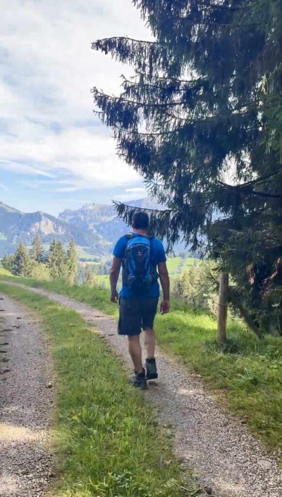
Our hike begins at the historic starting point, Restaurant Schärligbad in Marbach. From here, the path winds steadily uphill towards Pfyffer. Soon, views of the striking Schrattenfluh and the Beichlen range open up.

The Pfyffer (1,315 m) marks not only one of the highest points of the tour but also the border between the cantons of Lucerne and Bern. On a clear day, the panorama stretches from the Bernese High Alps—with Eiger, Mönch, and Jungfrau—far out into the Swiss Plateau.

Rämisgummen: The Heartpiece and the Sea of Crocuses

From the Pfyffer, the hike leads across gentle ridges to Rämisgummen. This is the moment to check your phone or hiking map: You are currently standing exactly at the tip of the “Heart-Route.”

A tip for spring lovers: If you plan the Schärligbad circular hike for April, you will experience a world-class natural wonder. The Rämisgummen transforms into a glowing sea of white and purple crocuses. It is one of the most beautiful places in Switzerland to photograph the awakening of spring in the mountains.

Descent and the Perfect Culinary Finale

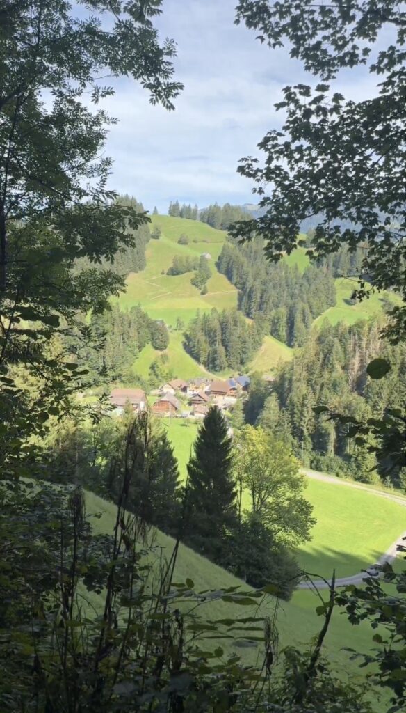
The return path leads us leisurely back downhill via Alp Geissholle and the Sattel. The route is diverse and offers ever-changing perspectives of the “Wild West” of Lucerne.

After about 4.5 hours (including breaks), we reach our destination: Restaurant Schärligbad. Anyone who doesn’t crave an authentic Entlebuch Cordon Bleu after this tour can hardly be helped. The combination of physical activity on the “Heart-Route” and the subsequent indulgence makes this day perfect.

More Impressions of the Schärligbad Circular Hike

Scroll to Top