The hike from Gstaad over Col de Jable to L’Etivaz is only suited for expert hikers. It is 16km long and takes you 1300 meters uphill and 1200 meters downhill. It took us about 7 hours to complete. On this hike you will cross Col de Jable, one of the Via Alpina’s 14 mountain passes.
+1300m -1200m
7:00 hours
16km
Expert
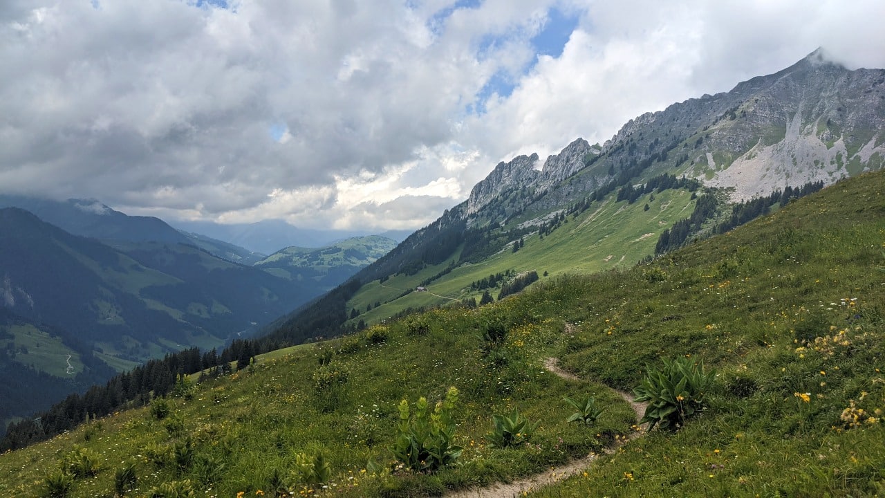
Hiking Trail on the Via Alpina from Col de Jable mountain pass to L’Etivaz
Our experience hiking on the Via Alpina from Gstaad to L’Etivaz
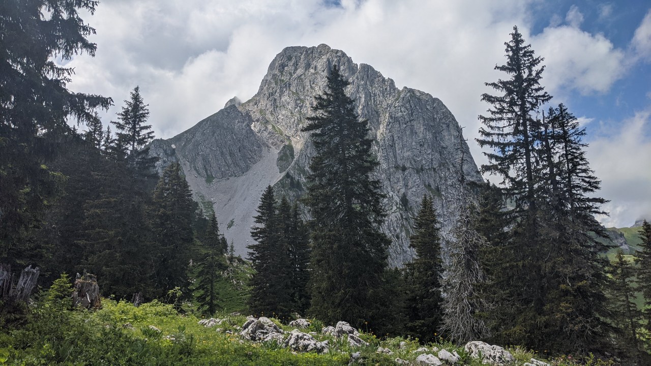
We hiked on the Via Alpina from Gstaad to l’Etivaz in July 2020. On this hike we enjoyed fantastic views of Gummfluh mountain, les Diablerets and Rochers-des-Nayes. We hiked over the Col de Jable pass that marks the border between the French- and German-speaking part of Switzerland. We ended the hike in L’Etivaz where the world famous cheese with the same name is produced. Read more about our hike on the Via Alpina from Gstaad to l’Etivaz below.
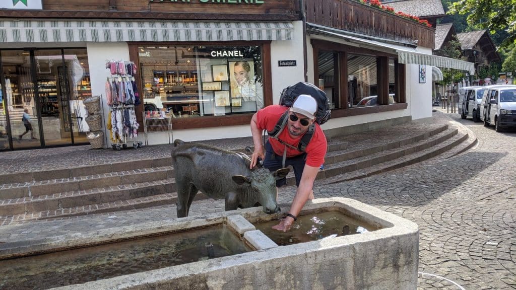
Matthias pretending to feed a statue of a calf at a fountain the heart of Gstaad
Leaving Gstaad – uphill
The hike up from Gstaad to Berghaus Eggli is steep! Luckily the cable car was not running that day. Otherwise we would have been tempted. From Obers Motzi to Hinders Eggli the trail turns into a broad gravel road. From Hinders Eggli the Saanenland lay to our feet.
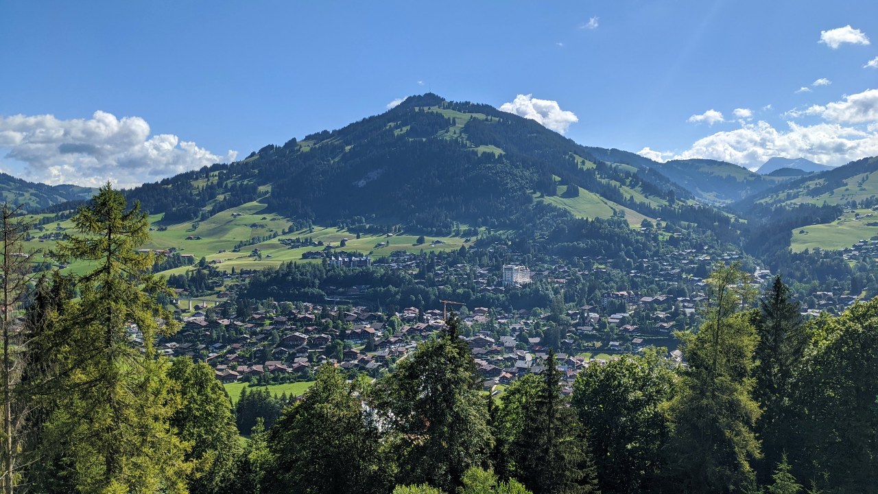
View from the Via Alpina to Gstaad, Switzerland
The Via Alpina from Gstaad: views to Gummfluh, Le Rubli and Col de Jable
The region called Saanenland is a beauty. We couldn’t get enough of the views to Gummfluh and Le Rubli mountain. Ahead, the Col de Jable mountain pass was in sight. We were already hungry and before Hinders Eggli, we stopped by a farm and ate a plate of cheese and local meat. So delicious.
Crossing at Wilde Bode: Left the easy path up to Col de Jable. Right the tough trail through a forrest via Gummfluh to Col de Jable
Surprised by rain and thunder on the Via Alpina to Col de Jable
We hiked through a forrest to “Wilde Bode” when suddenly the weather changed. There were dark clouds above the Col de Jable pass and a cold wind started blowing. At the crossing in Wilde Bode, we decided to take the trail. Beginners watch out and stay on the gravel road! We didn’t realise that the small trail would bring us up to 1900m+ (Trittlisattel trail). It started raining heavily and at some point we almost gave up.
Solène’s Dine Pairing
Hike&Dine: Dine at Restaurant Les Jardins de la Tour in Rossinière
“From the moment we set foot in Patrick Gazeau’s restaurant in Rossinière, I felt enchanted. The chef himself creates all the dishes. The herbs and flowers are from his garden. Every course looks like a painting and tastes like heaven on earth.”
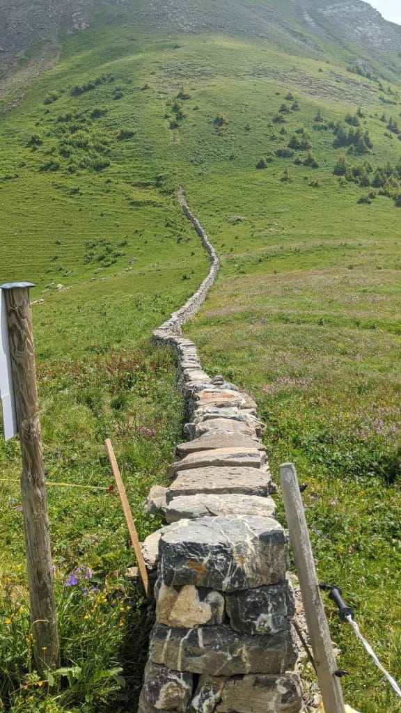
As there were no flashes – just rain and thunder – we waited for the rain to stop. We were disappointed by our guidebook. There was no mention of this trail. To be clar: allocate enough time for this hike because it gets steep before Col de Jable. We crossed some rocks and made it to the pass before it started raining again. On Col de Jable pass, a stonewall marks the language border between the German and French speaking part of the country. We did it, mon Dieu!
Solène hiking to Col de Jable mountain pass on the Via Alpina, Switzerland
Col de Jable mountain pass.
Hiking to l’Etivaz where the world famous cheese is made
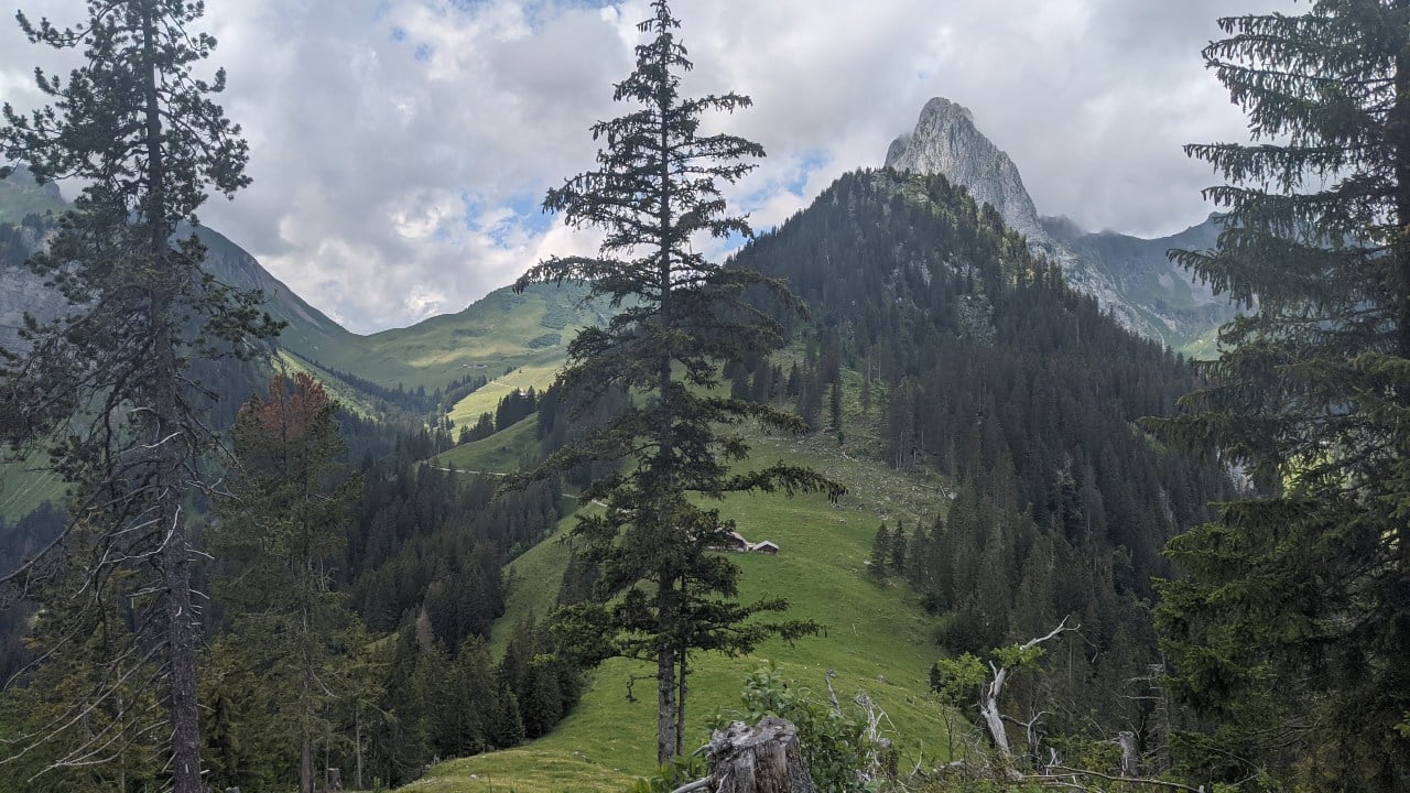
20 minutes after Col de Jable mountain pass we reached a farm with many cows. It started raining again. Luckily, the rain stopped after 15 minutes and we hiked on. For the next 2 hours we were hiking in a forrest downhill to L’Etivaz. After a long 7 hours (walking time) we finally reached the village that is world famous for its cheese. At the cheese store next to the bus stop we bought a slice and celebrated our success. Then we took the bus to Chateau d’Oex.
Gummfluh seen from Via Alpina hiking trail close to Col de Jable
Hike&Dine Tip
Hiking Philosophy
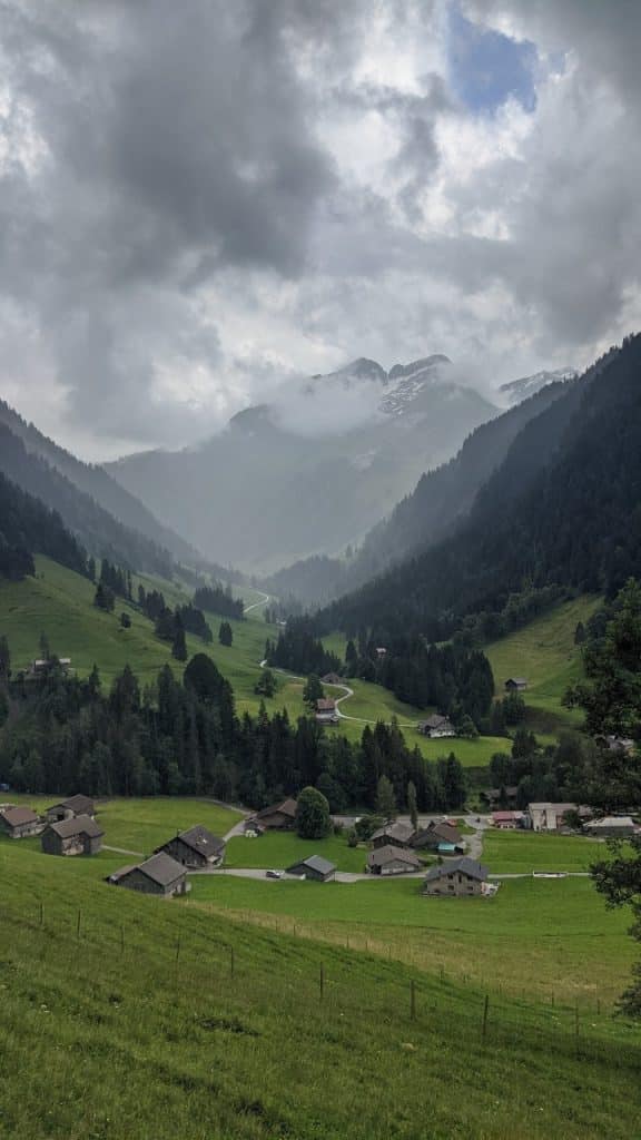
Le Pays-d’Enhaut is a region in the canton of Vaud, Switzerland. It is a beautiful spot on earth. Only 4500 people live in this rural region.
The main village is Chateaux-d’Oex, known for the international hot air balloon festival that takes place once a year. That’s why Le Chateaux-d’Oex is also called “the world capital of hot-air ballooning”.
Most Swiss have never heard of this area between Gstaad and Montreux. The region is a mystical yet wild-romantic place. Wafts of myst are travelling along the green hills and through forests of which there are many.
Cows are chilling on every hill. With their milk cheese makers produce about 430 tons of L’Etivaz cheese every summer. We also explored the village of Rossinière with it’s beautiful old houses. We enjoyed the good food, the hospitality of the locals and definitely want to come back to explore this area further.
Beautiful landscape in Switzerland: Pays-d’Enhaut region with L’Etivaz village
Practical information
Prepare your hike from Gstaad to L’Etivaz
Get to Gstaad or L’Etivaz from anywhere in Switzerland. Look up trains directly on the site of Swiss National Railway (SBB) by typing in the starting point and Gstaad / L’Etivaz as the destination.
Bring food and water. We stopped at a farmers’ place to eat cheese. Besides Berghaus Eggli we did not see any restaurants.
On the site of SwitzerlandMobility you can download an altitude profile and find a map of the hike.
As always, check the weather conditions. We were surprised by a bad weather front on Col de Jable. There is no restaurant up there that offers shelter. Plan carefully.
Chateau-O’ex is the perfect starting point to explore Le Pays-d’Enhaut. The train stations offers connections to Rougemont, Gstaad, Zweisimmen or in the other direction to Rossinière, Gruyère and Montreux, respectively.
If you have an extra day, try out the Belle Epoque train and travel back in time.
We sent our extra bag by train from Lenk to Chateaux-d’Oex so we did not have to carry everything.
Matthias bezeichnet sich selbst als Gourmet-Wanderer: Seiner Meinung nach geht nichts über ein feines Essen nach einem Wandertag. Auf Hike&Dine möchte er seine schönsten Erlebnisse in den Schweizer Alpen mit Ihnen teilen.
Matthias calls himself a gourmet hiker: in his opinion, nothing beats a delicious meal after a day of hiking. On Hike&Dine he wants to share his favourite experiences in the Swiss Alps with you.