Sils-Maria (1809m) – Alp Muot (1950m) – Piz Chüern (2689m) – Lej Sgrischus (2618m) – Furtschellas (2313m) – Sils-Maria
Hiking Val Fex: How to get there
| Location | Sils Maria, Engadine region, Canton Grisons, Switzerland |
| Starting point | Sils Maria |
| Starting point of the hike | Nietzsche-Haus (Sils Maria) |
| The end point of the hike | Sils Maria |
| Highest point of the hike | Furtschellas (2786 m) |
| Arrival by public transport | Arrival by train via St. Moritz. Change to a post bus to «Sils/Segl Maria, Posta» |
| How to get there by car | Travel time from Zurich: approx. 2 h 40 | Travel time from Bern: approx. 3 h 40 |
| Parking | Car park in Sils Maria (address: Via Fedacla 1) |

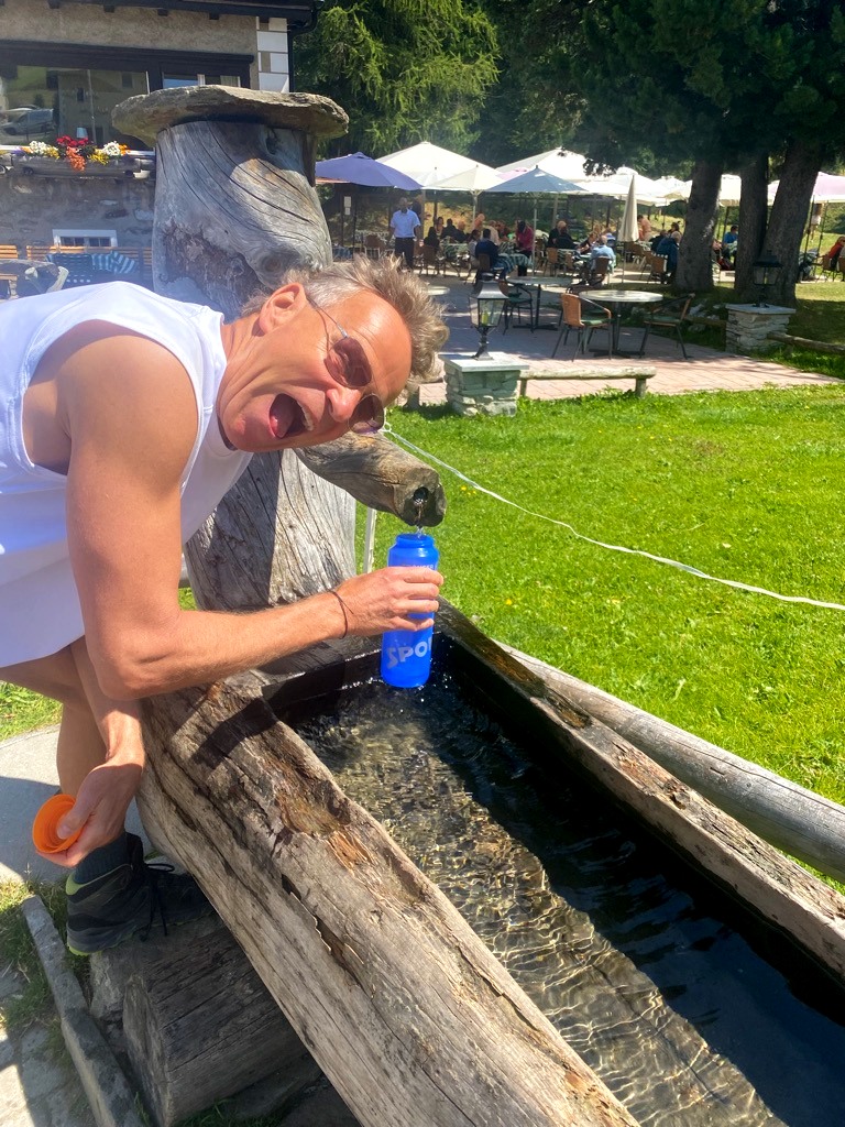
Dine-Tip on the hike Val Fex
«Coming soon: Marc will take you to the Restaurant/Hotel Sonne Fex.»
Hike Val Fex: Facts and Figures
| Walking time | 5 h |
| Recommended hiking months | June to October |
| Difficulty | Medium |
| Type of hike | Circular hike, alpine hike |
| Waypoints | Sils Maria– Alp Muot – Piz Chüern – Lej Sgrischus – Furtschellas – Sils Maria |
| Terrain | Mountain trail, natural ground, gravel path |
| Altitude meters | 880m vertical meters uphill | 376m vertical meters downhill |
| Restaurants | Hotel Retaurant Sonne Fex |
| Highlights | ✅ Enjoying peace and quiet in Val Fex ✅Lake Lej Sgrischus ✅View of Lake Sils and Lake Silvaplana |
| Good to know | Depending on the season, the last descent from Furtschellas to Sils is at 5:05 p.m. |
| Webcam & Weather | The current weather situation in Val Fex can be seen on this webcam or here. |
Free interactive map of the hike Sils-Maria in the Val Fex valley.
Here you can find a free map of the hike in the Val Fex Valley (Sils Maria – Alp Muot – Piz Chüern – Lej Sgrischus – Furtschellas). In addition, you can download a GPX file of the hike here, which you can then use with your smartphone or smartwatch. Below you will find an interactive map of the round-trip hike Sils-Maria in the Val Fex Valley.
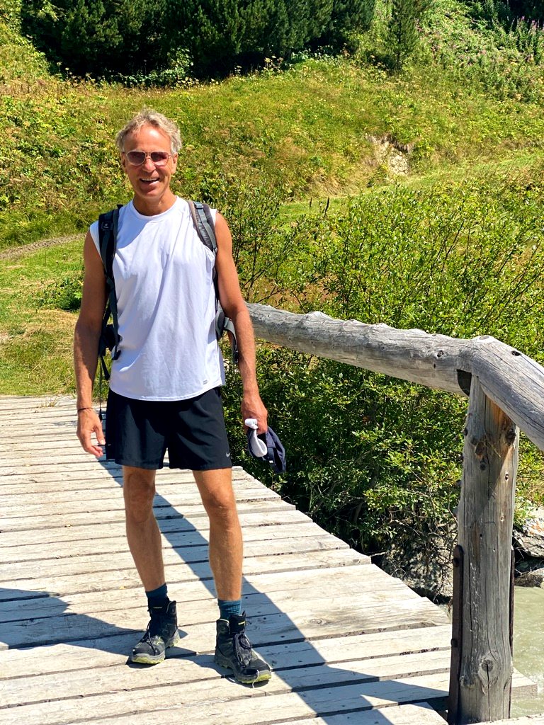
My experience hiking on the Val Fex trail
I enjoyed the picturesque Val Fex trail on a pleasant August day. As the quiet Val Fex valley lies between 1800 and 2000 meters, the temperatures are never getting too hot, even in the sizzling hot summer we’ve experienced this year.
Hiking car-free Val Fex has always been high on my To Do list as it is a well-preserved, sunny nature enclave with only a few permanent residents, no ski infrastructure, no power lines, and plenty of pure, plain nature.
Val Fex Arrival: from Sils-Maria to Alp Muot
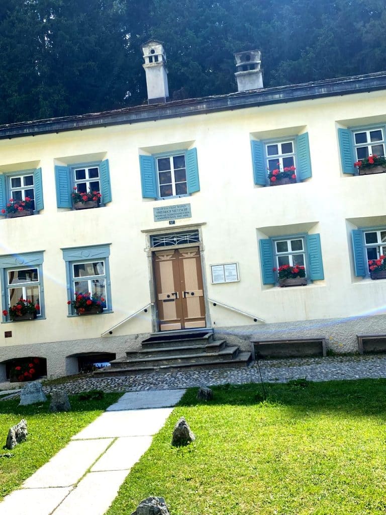
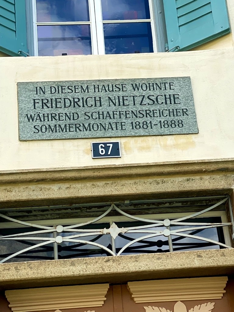
I arrived by car in Sils-Maria – the Engadin’s place of power – and first admired the Nietzsche House where the famed writer lived from 1883-1888.
The raging Fexbach river (Fedacla in Romantsch) flowing through Sils-Maria carried enormous amounts of brown ice melting water, further evidence of the aggressive glacier meltdown taking place on the peaks high above the Val Fex. One can also easily bike to Sils-Maria along the sparkling blue Engadin lakes or take the post bus. I then followed the sign post towards Val Fex and Fex Platta.
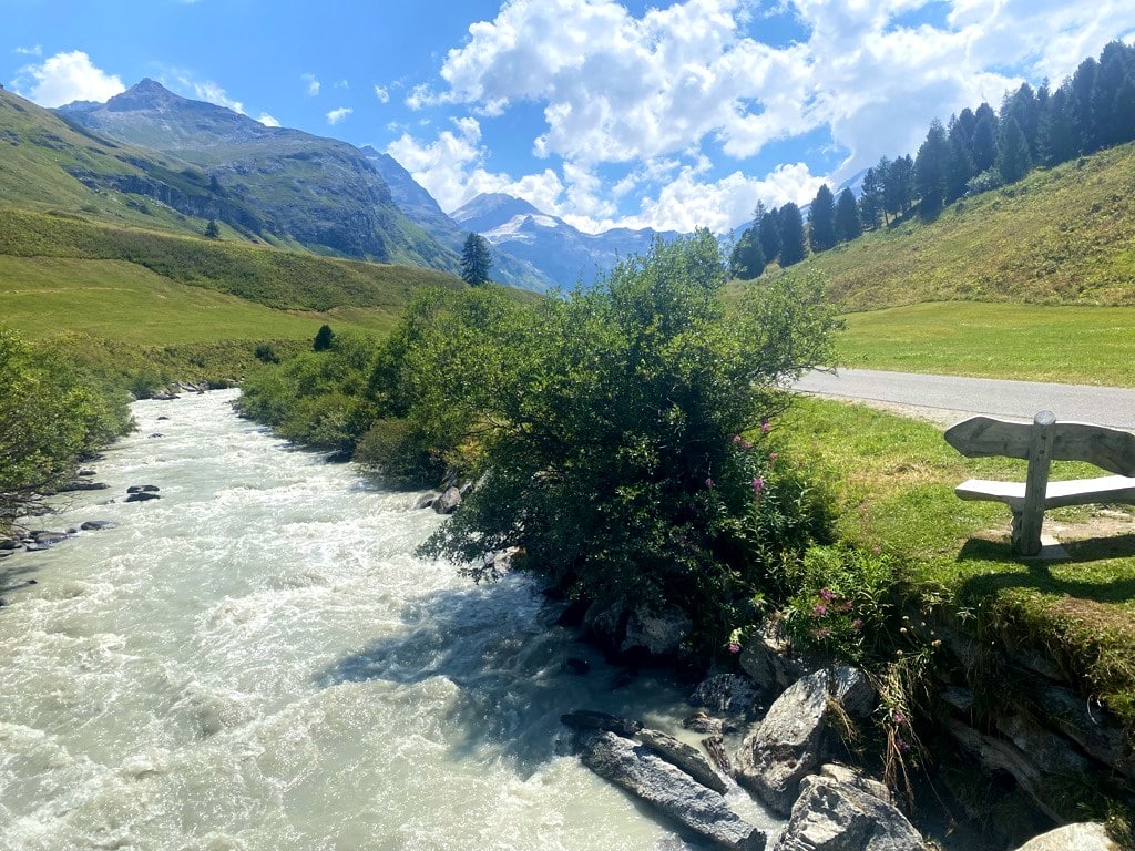
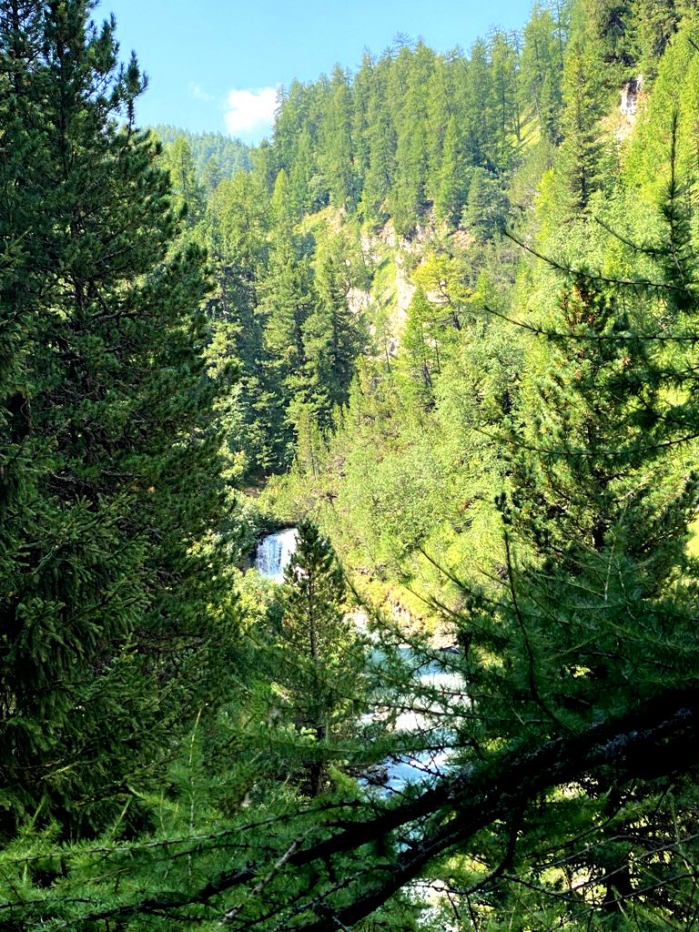
On the Val Fex Trail from Sils-Maria to Piz Chüern
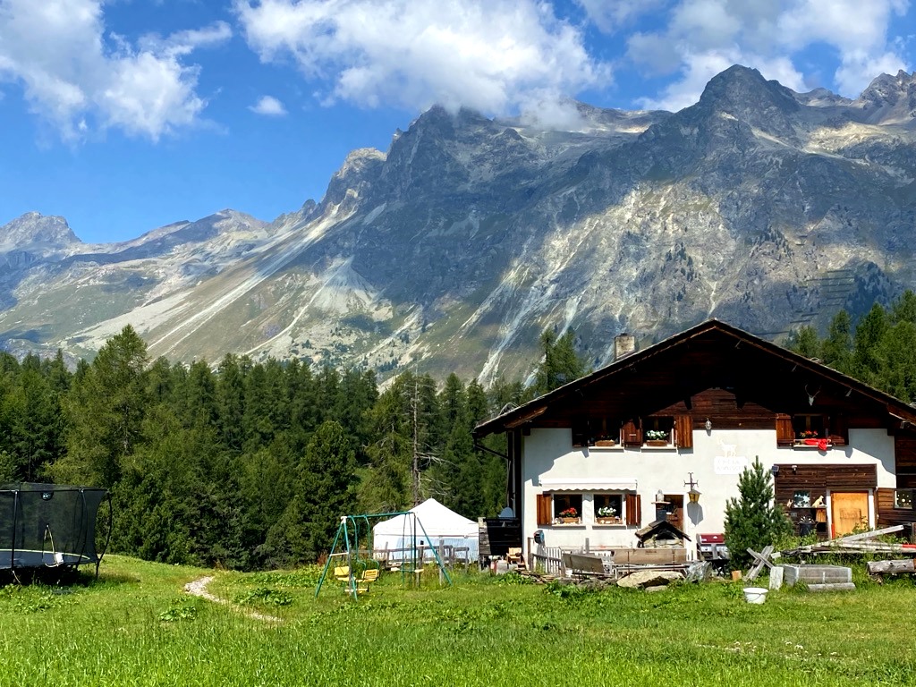
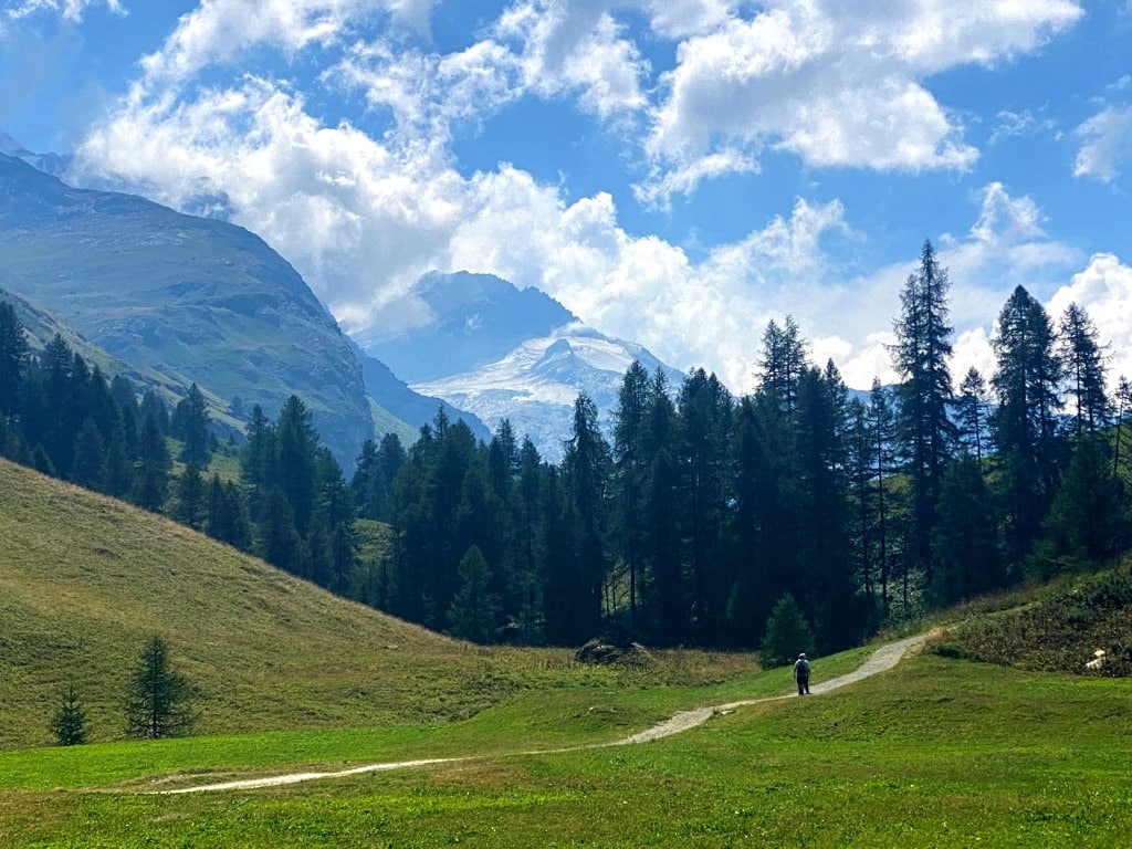
The initial steep ascent through the impressive, narrow Sils Gorge is already spectacular. The trail’s slope then gradually loosens its incline and the sound of the raging Fexbach down below in the gorge matched the peaceful calmness of the green pastures, meadows, and rich alpine flora. Towards Alp Muot and the hamlet of Fex Platta, one hikes through good-smelling larch and pine forests. On that particular day (as most likely on any day), there were clearly more grazing cows than humans in Val Fex.
Spectacular views on the way to Piz Chüern along the Val Fex trail
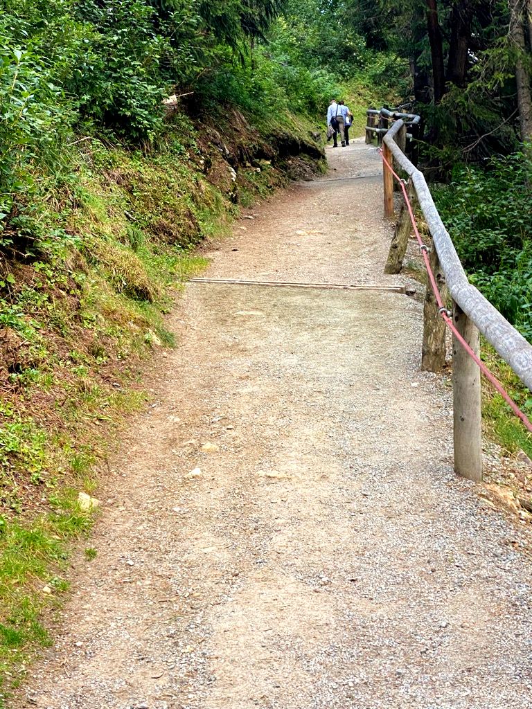
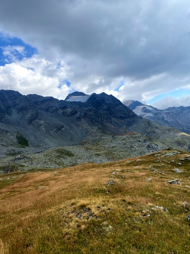
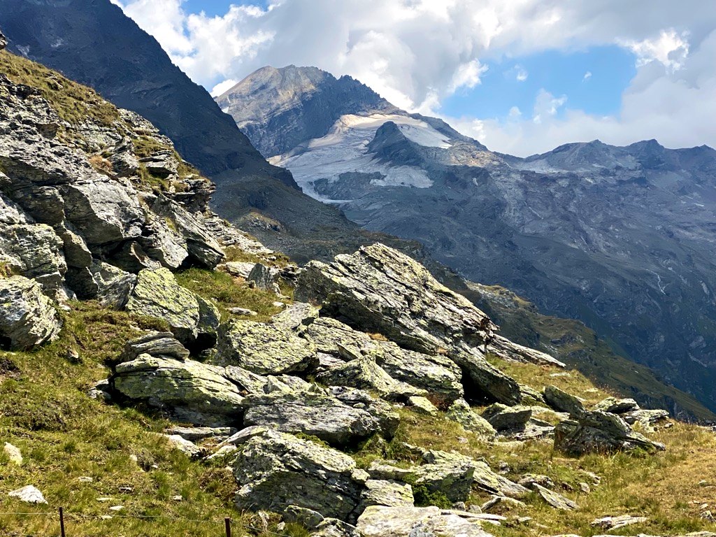
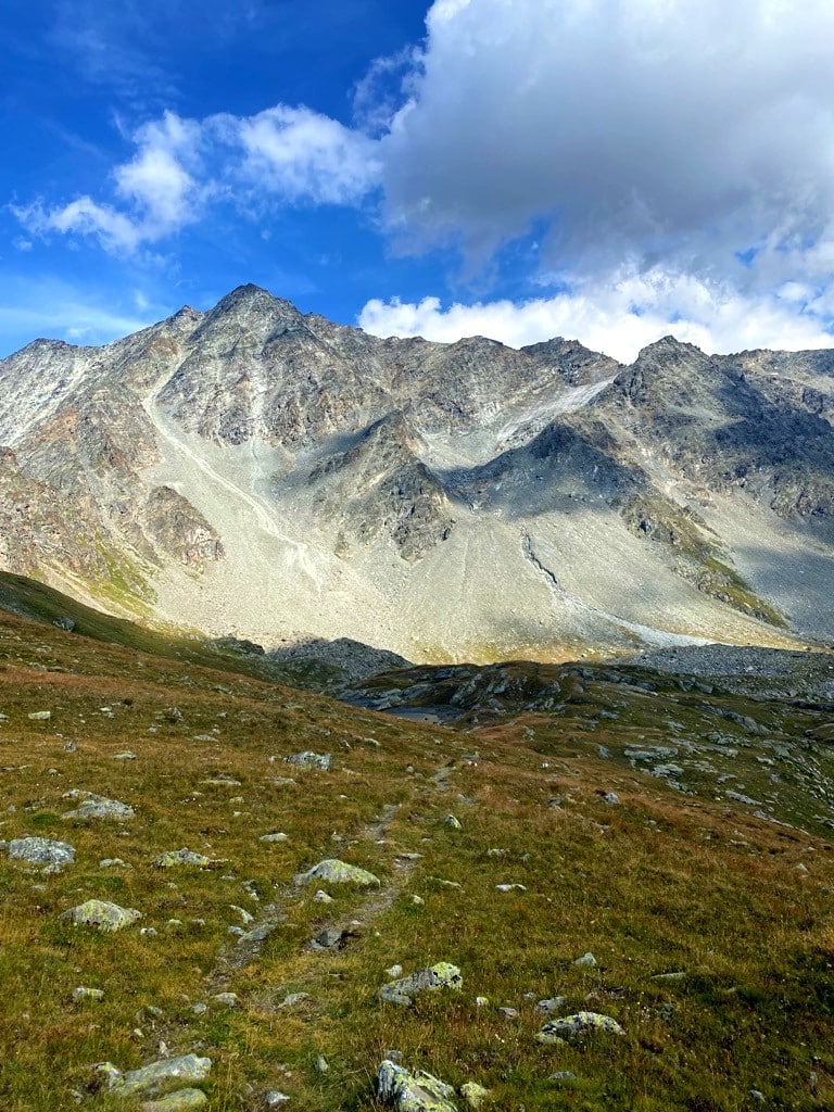
After approximately one hour of hiking on the Val Fex trail, the wide gravel path turned instantly into a typical, narrow, and steeper mountain trail, zig-zagging up towards Piz Chüern. Make sure to turn left across the Fexbach prior to reaching the hamlet of Muot. The signpost will point you towards Lej Sgrischus and Piz Chüern. With every turn of the steeply climbing trail, more of the glacial peaks encircling the end of Val Fex appear. The Piz Tremoggia (3441m), Piz Fora (3363m), and Il Chapütschin (3388m) are the most dominant peaks, while the Fex Glacier closes out the valley. The trail crosses numerous, gushing mountain streams – a welcome cool-down on the way up. Even at an altitude well above 2000m, the Alpine flora was still colorful and versatile.
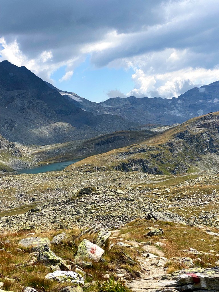
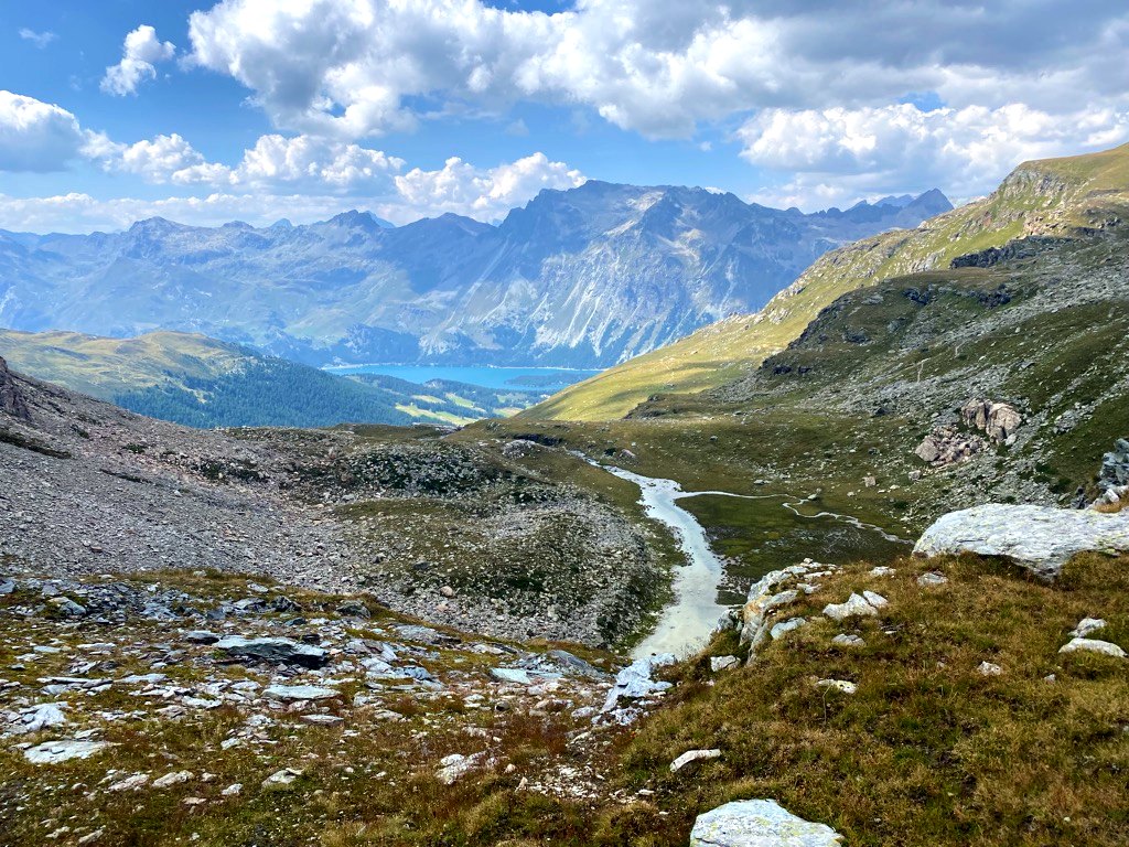
From Piz Chüern to Lej (Lake) Sgrischus on the Val Fex trail
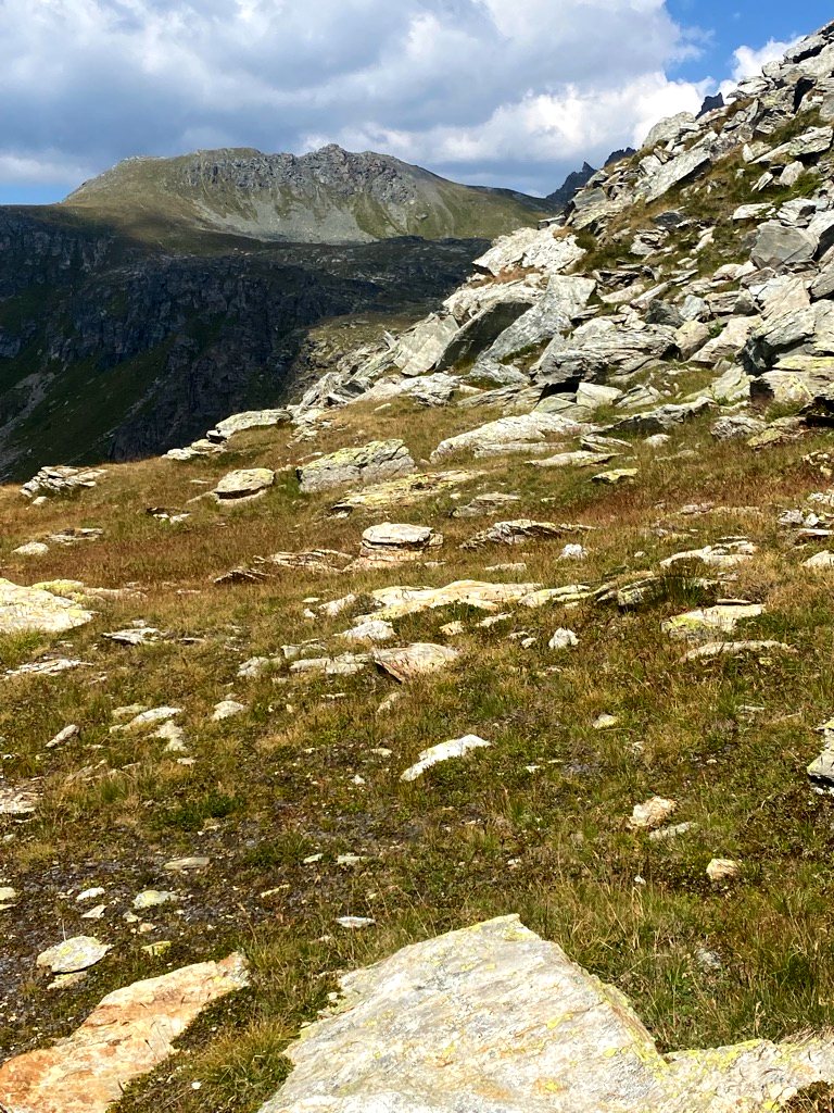
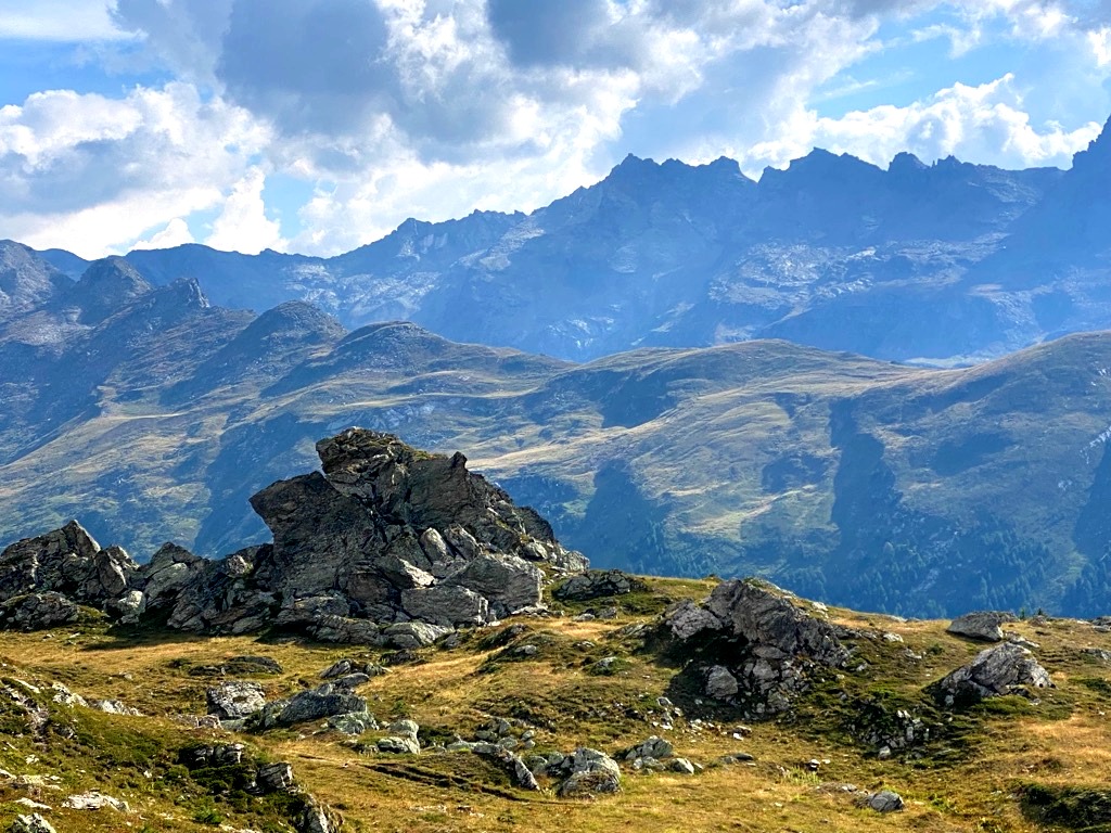
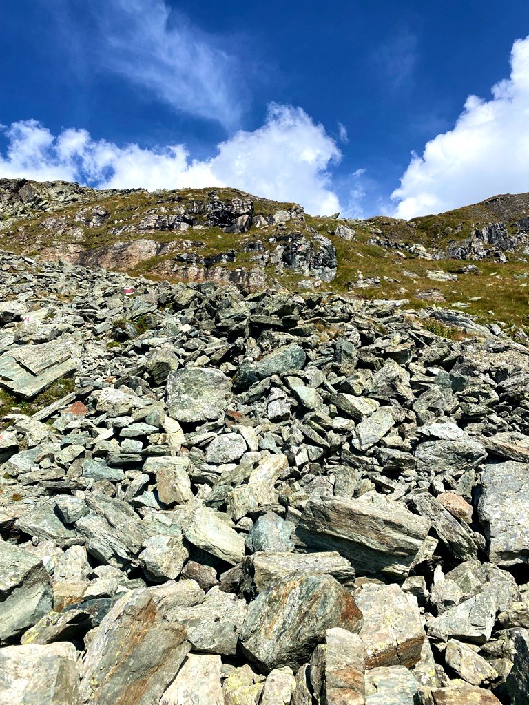
The final ascent towards Piz Chüern is quite rocky and demands sure-footedness and stability. The North face of Piz Chüern drops vertically and steeply while the Val Fex hiking trail descends softly over green meadows to the lake Lej Sgrischus. However, prior to descending to the lake, take in the stunning views towards Piz Corvatsch (3451m), the previously mentioned peaks, and the sights all the way back to Lake Sils.
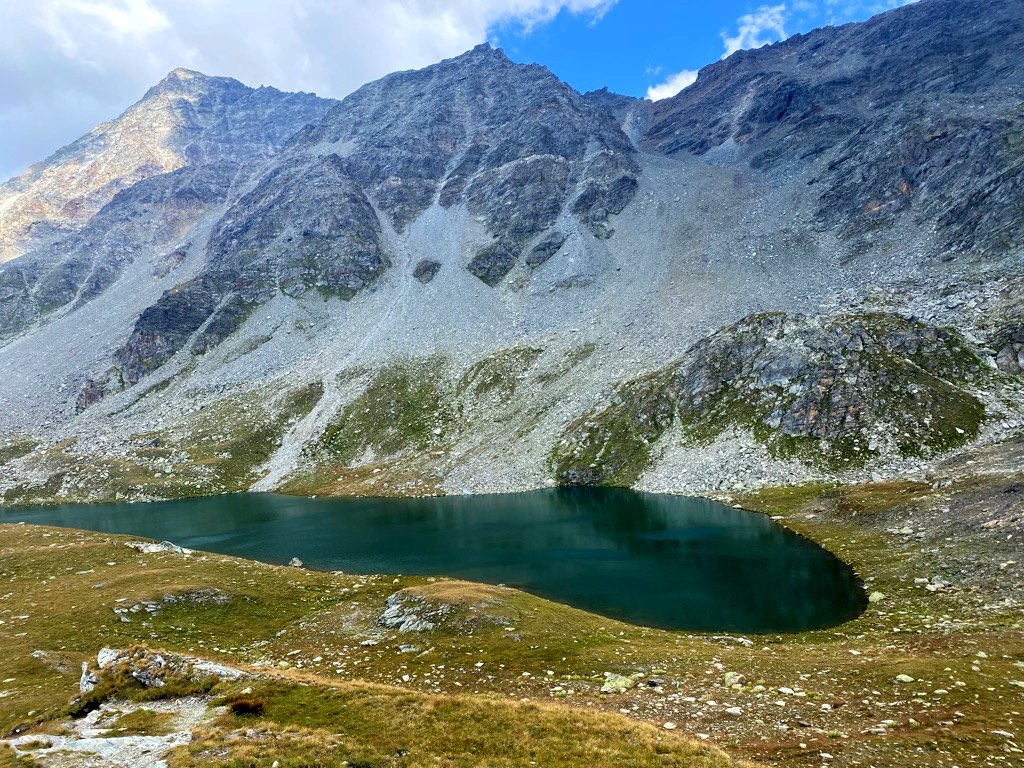
A welcome cool-down in Lej Sgrischus
After the short hike down to Lej Sgrischus on the Val Fex trail, I decided to take a jump into the surprisingly warm mountain waters. Fun fact: Lej Sgrischus in Romantsch means “horrible lake” – nothing could be further from the truth on a bright, sunny warm day as its blue waters are quite a treat….
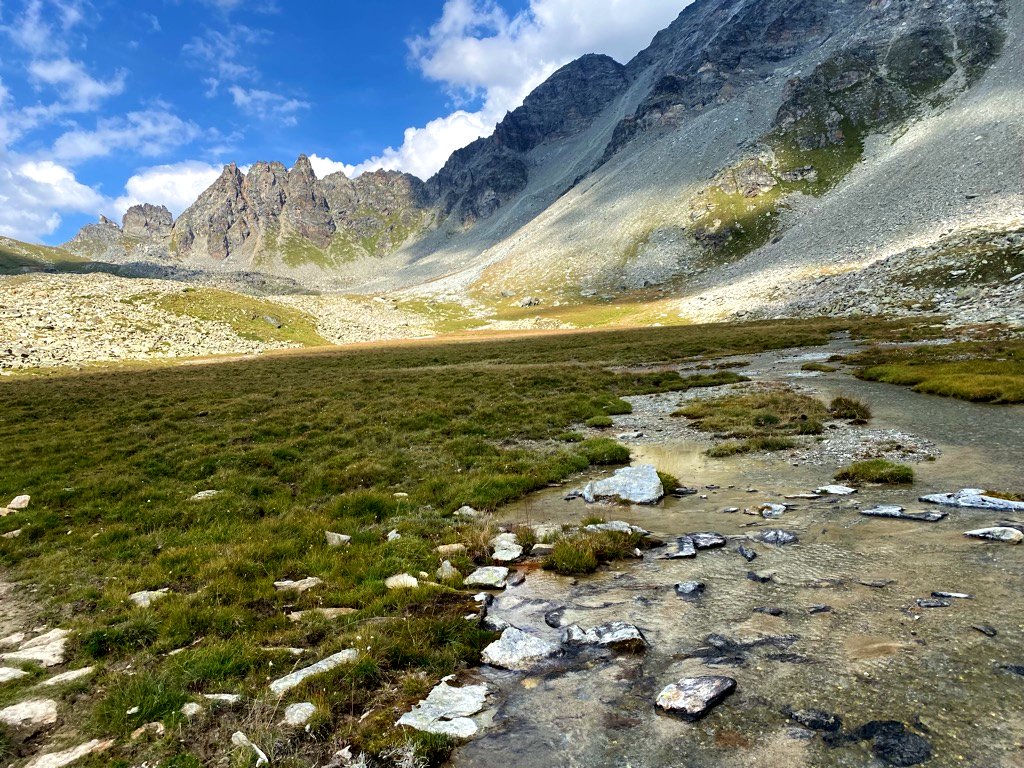
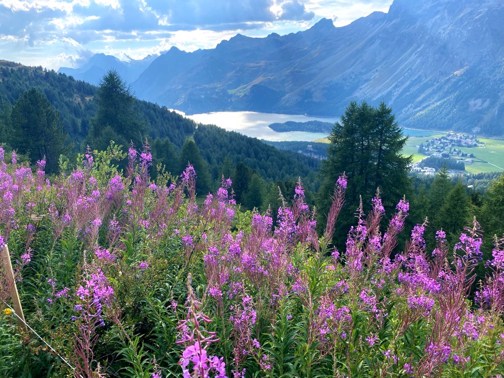
Lej Sgrischus to Furtschellas and Sils-Maria on the Val Fex trail
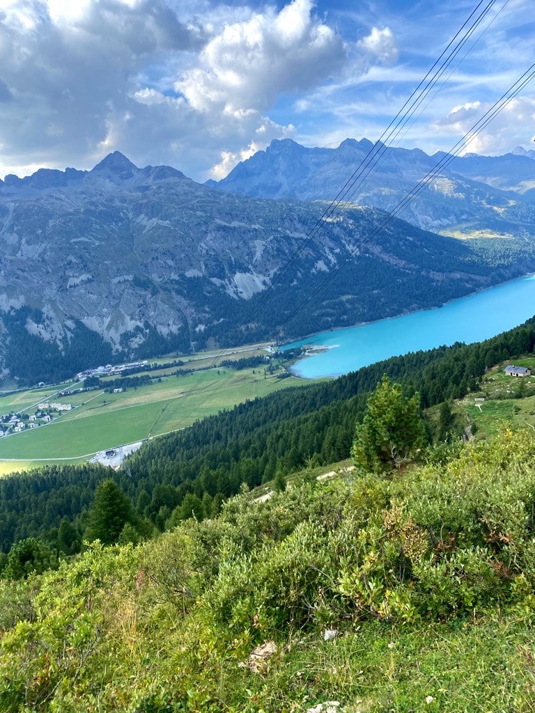
The next stretch from Lej Sgrischus to the Futschellas gondola station along the Val Fex trail offers more stunning views of the main Engadin valley and the mountains surrounding Val Fex. The Val Fex trail passes literally below the impressive Piz Corvatsch massif, high above pristine, green mountain pastures and many small mountain ponds.
A word of caution: There are two options to reach Futschellas
There are two options to reach Futschellas from Lej Sgrischus on the Val Fex trail: The easier, flatter one demands a left turn down towards the small hut on the Alp Munt; this trail eventually merges with the more challenging descent from the upper trail that initially ascends across many small ponds and pastures and awards even more impressive views. It then drops quite steeply towards the end underneath the Grialetsch rock formation before merging with the lower-level trail.
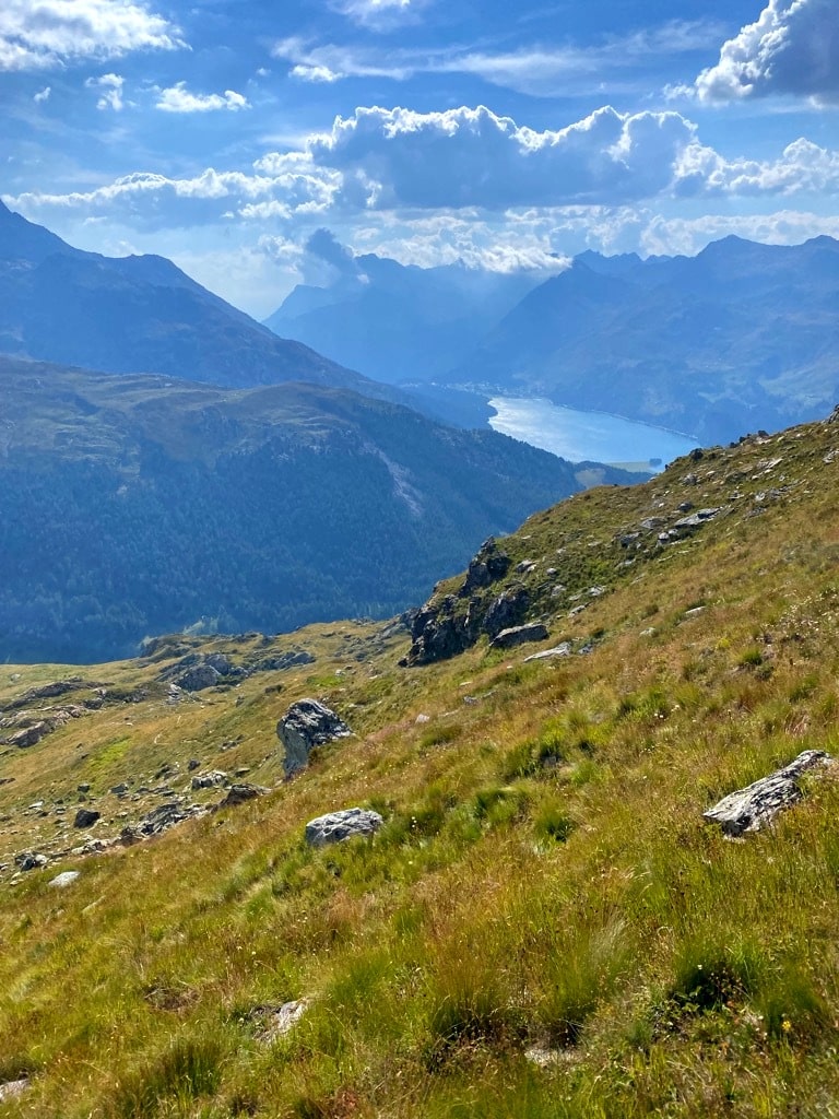
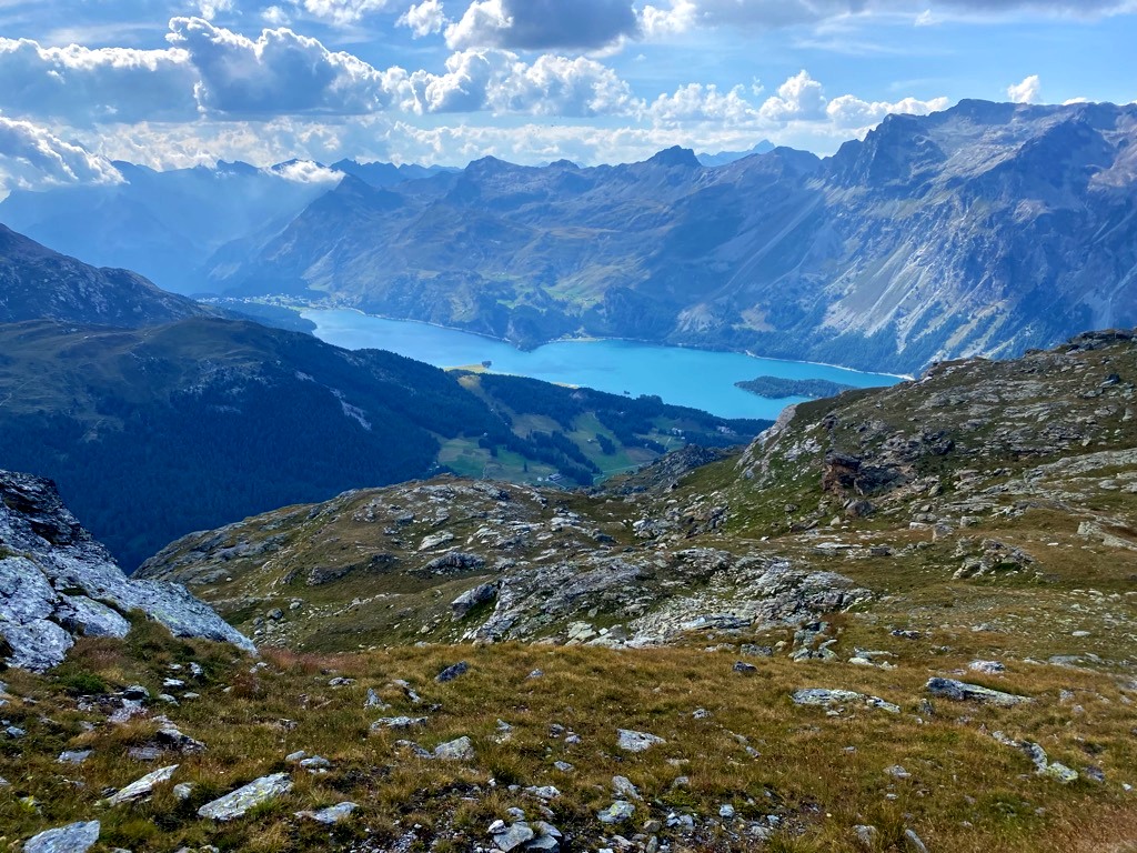
I thoroughly enjoyed the peace and quiet on this upper trail option as most people take the lower-level trail. Several chamois and the sounds of numerous marmots enriched the Val Fex hiking experience up there. As you approach the final ridge underneath the Grialetsch rock formation, a surprisingly wide view opens up towards the Engadin Valley, Lakes Sils and Silvaplana, and even the peaks behind Maloja.
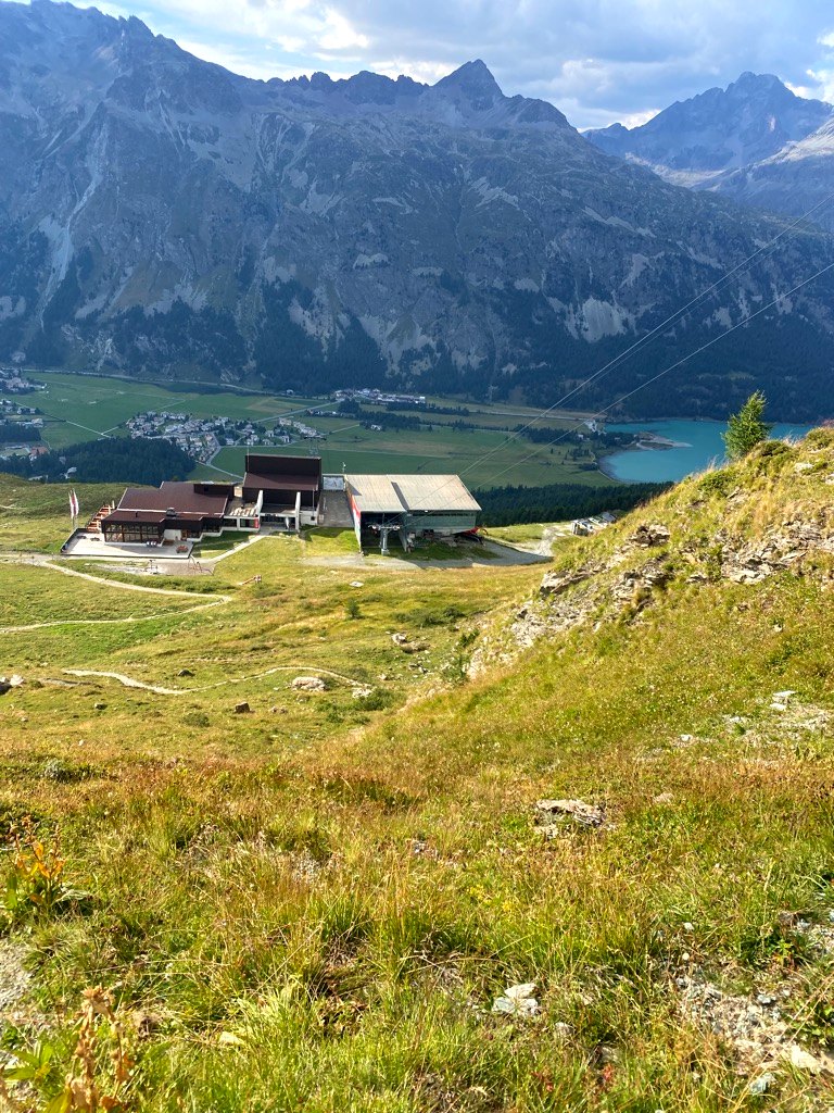
Val Fex: Futschellas gondola to get back to Sils-Maria
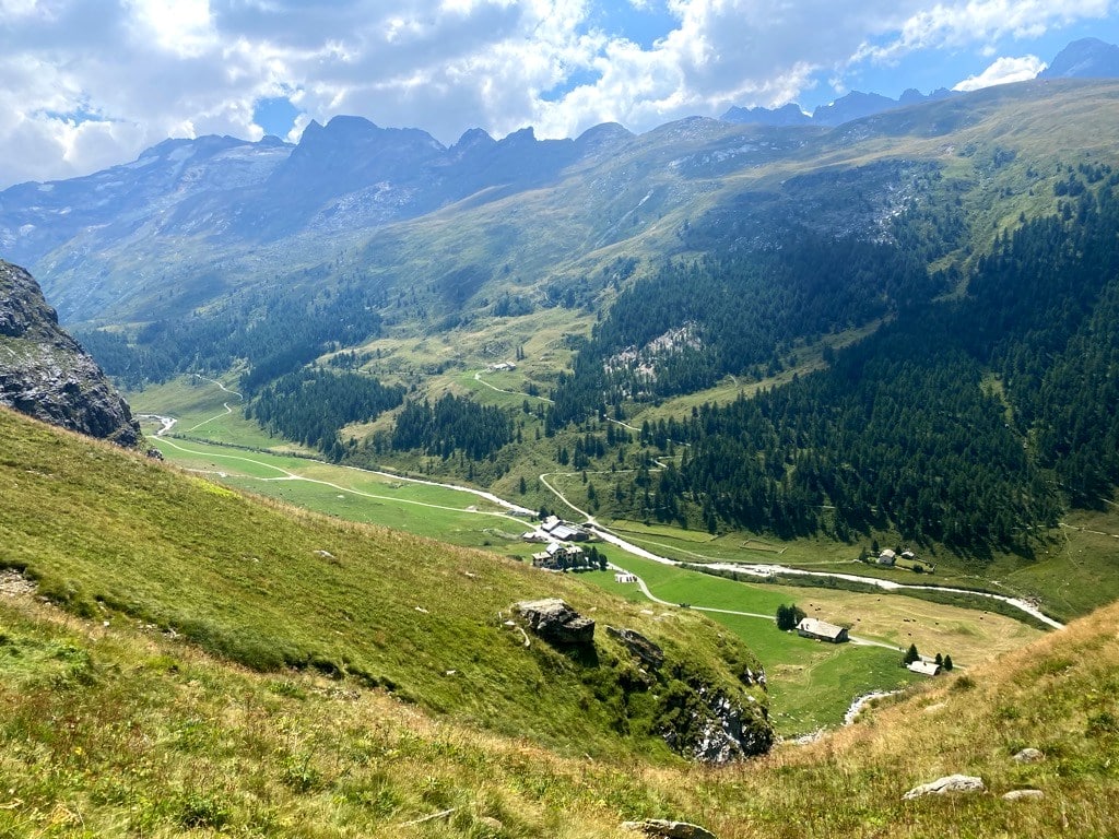
If your knees start to feel tired on that last segment on the Val Fex trail and it is getting late, make sure you check the schedule of the Futschellas gondola’s final valley run. It will save you 500 vertical meters. I was cutting it very close and ended up running downhill towards the station, but ultimately missed that final ride. In the end, though, it was a blessing as I was forced to take the beautiful nature hike down to Sils along the lush, green, and flowery ski piste pastures, ultimately getting me to a magical forest and swamp area from where a narrow trail led me back to the starting point of the Val Fex trail at the Nietzsche House.
Conclusion of my hike along the Val Fex trail
In all, I enjoyed the versatility in landscapes, geology, stunning views, lakes, and streams on this pure nature hike in and above the Val Fex. An extra bonus of the Val Fex trail was the various wild animals I could observe and the refreshing swim in Lej Sgrischus. It was also pleasantly empty on the trail, so I felt truly at one with nature and the mountains – heavenly!! The locals told me that in the winter and spring times, the segment of the Val Fex trail down on the valley floor is also a favorite for snowshoeing.
Of course, one can also do the Val Fex trail vice versa – i.e., take the gondola Futschellas (an instant gain of 500m in vertical) or hike up to Marmorè and then towards Piz Chüern on the same trail. Personally, I always prefer hiking more up rather than down, so I followed the described route.
Things to do near Sils: Sky paragliding Silvaplana
If you are in the Sils region for an extra day and want to see the mountains from a bird’s eye view, we recommend paragliding in Silvaplana. The flight takes 20 minutes, and the whole activity about 1.5 hours. Book your ticket right here:
Val Fex Hike: Impressions from the trail
Find more pictures of the Val Fex trail